San Bernardino County[SBC]
Connecting & Encouraging the Body of Christ to Pray for Revival in SBC
Search Results
155 results found with an empty search
- Redlands
updated 05/19/25 Redlands City Web Site Location : The city is located 10 miles (16 km) east of downtown San Bernardino. Nearby cities include Highland to the north; Mentone to the east; Loma Linda to the west; Riverside to the south. Demographics ; estimated population [2024] 72,985; 6% under 5; 23% under 18; 14% over 65; M:F 49:51; white only 61%; African American 6%; Hispanic 37%; white not Hispanic 44%; Asian 8%; other .8%; 3,765 veterans; foreign born 14%; 59% own homes; median value of homes $456K; median mortgage $2385 & rent 1600; 94% have a computer; 84% have internet; 89% high school grad or higher; 44% bachelors or higher; 63% employees 16 & older; average time to work is 24 minutes; median household income $87K; average income per person $42K; poverty 8.7%. Map of Redlands Location of Redlands in SBC History The area now occupied by Redlands was originally part of the territory of the Morongo and Aguas Calientes tribes of Cahuilla people. Explorations such as those of Pedro Fages and Francisco Garcés sought to extend Catholic influence to the indigenous people and the dominion of the Spanish crown into the area in the 1770s. The Serrano (Mountain-dwelling Cahuilla) village of Guachama, located just to the west of present-day Redlands, was visited by Fr. Francisco Dumetz in 1810, and was the reason the site was chosen for a mission outpost. Dumetz reached the village on May 20, the feast day of Saint Bernardino of Siena, and thus named the region the San Bernardino Valley. The Franciscan friars from San Gabriel established the San Bernardino Asistencia in 1819 and embarked on the usual program of training the native tribes to raise crops and encouraging permanent settlements. By 1820, a ditch, known as a zanja, was dug by the natives for the friars from Mill Creek to the Asistencia. In 1822, word of the Mexican triumph in the War of Independence reached the inland area, and lands previously claimed by Spain passed to the custody of the Mexican government. In 1842, the Lugo family bought the Rancho San Bernardino Mexican land grant and this became the first fixed settler civilization in the area. The area northwest of current Redlands, astride the Santa Ana River, would become known as Lugonia. In 1851, the area received its first Anglo inhabitants in the form of several hundred Mormon pioneers, who purchased the entire Rancho San Bernardino, founded nearby San Bernardino, and established a prosperous farming community watered by the many lakes and streams of the San Bernardino Mountains. The Mormon community left wholesale in 1857, recalled to Utah by Brigham Young during the tensions with the federal government that ultimately led to the brief Utah War. Benjamin Barton purchased 1,000 acres (4 km2) from the Latter-day Saints and planted extensive vineyards and built a winery. Motto: “Live. Work. Play" Specific Prayer Points Government : Current City Council | Under County 3rd District School district: University of Redlands ; Redlands Unified School District Crime grade : [2024] Overall grade is C-; violent is C-; property crime is D+ and other is B+. Top issues theft at 12%. Poverty Issues: [2024] 7.37% < 4.53% CA Avg 12% Points of interest : Redlands Community Hospital [ opens new center for cancer care ]; hosts Redlands Bicycle Classic presented by San Manuel Band of Indians; Redlands Rotary Club Spiritual : pastors connect and pray together for revival, transformed lives and reformation; intercessors to rise up and claim this region for the Lord, laborers for the harvest, awakening to those sitting, spiritual gifts operate in the body of Christ, matching giftings & skills to ministry opportunities in and outside of the church walls, outreaches to be successful, many people saved & set free from bondages, recovery groups to help people maintain freedom & accountability, enough finances to support the God-sponsored activities. Churches [not exhaustive] Acts Center - Redlands, CA American Baptist Amethyst Bible Church Assembly Of God Church Bethany Reformed Church Calvary Chapel Redlands Celebration Center, Non-Denominational Christ The King Luth Church Christian and Missionary Alliance Christian Reformed Church in North America Church of the Nazarene Church On the Hill Non-Denominational Community Missionary Baptist Church Community Presbyterian Church Cornerstone Bible Baptist Church Covenant Family Church Non-Denominational CrossWalk Church, Seventh Day Adventist Cucamonga Christian Fellowship: CCF Redlands (formerly Brookside Church) Discalced Carmelites of the Western Province Evangelical Covenant Evangelical Free Church First Baptist Church First Congregational Church, National Association of Congregational First Evangelical Lutheran Church First Missionary Baptist Church First Presbyterian Church First United Methodist Church of Redlands Free Methodist Church of North America Highest Praise Apostolic Church Ho E Center Hope Protestant Reformed Church Iglesia Bautista Bethel Inland Empire Filipino SDA Church Isaiah 61 Ministries My Father's House, Non-Denominational Loma Linda Indonesian SDA Church Oasis Church, Non-Denominational Pathway Church, Southern Baptist Convention Redlands Apostolic Church Redlands Christian and MA Church Redlands Christian Center, Non-Denominational Redlands Church Of Christ Redlands Community Church Redlands Foursquare Church Redlands SDA Church Redlands United Church Of Christ Restoration Covenant Church River Christian Reformed Church Sacred Heart Parish Salvation Army Second Baptist Church Set Free Church Redlands Seventh Day Adventist, Loma Linda Japanese SDA Church Sisters Of Mercy The Ark Redlands (Church of the Nazarene) The Packinghouse Church The Salvation Army Corps Trinity Church - Redlands, CA Trinity Episcopal Church United Church of Christ United Pentecostal Church International University United Methodist Church Westside Christian Church World-Wide Missions
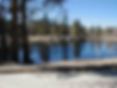
- Green Valley Lake
updated 05/04/2025 City Web Site Green Valley Lake is located between Arrowbear Lake and Big Bear Lake, 4 miles off of Highway 18. At 7000´, a higher resort community than either Lake Arrowhead or Big Bear. This “best kept secret on the mountain” is secluded and surrounded by National Forest. For all these reasons it has remained small, picturesque, and uncrowded. Very high days of sunshine compared with national average; 18 inches avg. rainfall & 21% snowfall; Mediterranean climate with moderate temperatures and regular rainfall except for warm dry summers. For all these reasons it has remained small, picturesque, and uncrowded; has something going on all the time with the lake that is stocked often with plentiful fish, and a small beach for swimming. Demographics : 42% Bachelors or Associates; 19% Masters; 34% High school; 5% less than High school; average age 41; average household income $60K; 15% poverty; Overall crime grade is F [see below for more details]; est. population [2024] 299. History 1880’s Timber claims made on Green Valley area by Highland Lumber Co. 1892-4 Horse trail from Fredalba lumber camp to Big Bear widened into toll wagon road by Bear Valley Wagon Rd. Co. Eleven-room Toll House was near entrance to campground. They gave the name of Green Valley to the area. 1893 San Bernardino National Forest “Reserve” created. 1894 Ben Pitts operates tollhouse each summer. Grows huge potatoes to serve guests. Leaves in 1902 to open hotel in Redlands. 1899 Highland Lumber Co. bought out by Brookings Lumber Co. 1900 Brookings begins laying narrow gauge railroad tracks in Running Springs. 1903 Tillitt family settles in Green Valley to run the tollhouse for Bear Valley Wagon Road Co & run it for 17 years. The general store, garage, and maintain the road. 1915 Trading Post and gas station built next to tollhouse. 1923 Deep Creek Cutoff completed (Hwy 18) to Big Bear. Nicknamed “Arctic Circle”. Cuts off Green Valley. 1924 Harry McMullen (Green Valley Mac) buys up property with idea of the dam; 1925 Dam construction begins along with roads. 1926 Dam finished. Lake is 8.5 acres. First lots to sell were the Tillits homestead lots that were saved from the logging in 1912. 1928 Lake stocked with trout for members of “Top of the World Club.” Clubhouse burned down in 1959 and site is now Community Center. 1934 So. Cal Edison ran power lines into the valley. By late 30’s land sales were good. 1938 Flood almost destroys dam. Jim Reid clears debris from spillway averting disaster. 1942-45 Mountains closed to all but local residents because of WWII. Wubbens build a small private ski run in back of their property; closed in 1962. 1973 Don and Ann Howe and Lyle Ferguson run the ski area. It was called the Snow Bowl. They continued to own it for the next 25 years. Around 1998, the Peake family take over the Ski Hill – It is renamed “Big Air Green Valley”. A chair lift system is brought in from Colorado. On Oct. 22 2007, the Slide Fire, pushed by severe Santa Ana winds, burns 12,759 acres and surrounds Green Valley Lake, destroying over 100 homes and three businesses, including Fox Lumber and the ski hill out buildings and ski lift. The cause was embers from the Sept. 14-21 Butler II Fire, which began from embers of the Butler I Fire, which was caused by a lightning strike on Sept. 1. 2012 in the Spring a community garden is created on the same lot where the Fox Lumber store used to stand. It becomes a community gathering place and the staging area for the Summer Concert Series. Along with the beautification project on the corner and the “Eddie the Eagle” statue, it marks a sign of hope that the town has recovered from the fire that nearly destroyed it. “The Best kept secret in the San Bernardino Mountains" Map of Green Valley Lake Location of Green Valley Lake in SBC Specific Prayer Points Spiritual Intercessors arise, encouraged as they pray against the crime issues & for souls to be transformed by the power of the Gospel For God to move in the Christian camps the one church to be used to bring reform, revival and deliverance City Council under Big Bear City Crime issues : [2024] overall crime grade is D+; violent crime D-; property crime D and other crime B+; top issues are theft 13%; burglary 6% Poverty Rate : [2024] 7% - 5% < CA Avg 12% Environmental issues : fires, lightning Points of Interest : Community Garden, Lilleberg Museum, Arts & Music with local artisans, musicians and craftsmen Churches [not exhaustive] Green Valley Lake church - Calvary Chapel Steve Harrison Hume SoCal - Hume Christian Camps Camp Cedar Crest - retreat center used for any type of group Camp Pondo - Christian camp nearby churches in Running Springs & Big Bear Lake & City
- Grand Terrace
updated 05/04/2025 City Web Site Grand Terrace, the Blue Mountain city, safe and well managed, known for its natural beauty and recreational opportunities; a vibrant and diverse local economy; a place where residents enjoy an outstanding quality of life that fosters pride and an engaged community, encouraging families to come and remain for generations. Became a city in 1978; located off the Interstate 10; south of Loma Linda; Bloomington to the west and Redlands & Mentone to the east; just below Colton. In 2007, voted the top 100 cities to live in according to the Money Magazine. Demographics : est. population [2024] 13,069; Median age is 36; 2.7 occupancy size per household; 62.6% of housing units are owner-occupied; $65,255 Median Household Income (6th highest of cities in San Bernardino County); $8,204 Annual Retail Sales Per Capita; 26% of residents possess a Bachelor's Degree or higher; 87% of residents have a High School Degree or above; 24.6 minutes for Average Travel Time to Work for Grand Terrace Residents; Ethnic breakdown of Grand Terrace residents include: 46.4% White; 39.1% Hispanic; 6.5% Asian; 5.6% Black; 2.4% All Other History | Video on History Grand Terrace's roots go back to Mexican land grants dating from the period between 1830 and 1840. Mormon settlers came shortly after, arriving in the San Bernardino Valley, during the 1850s. According to the Riverside Press, in 1876, there were nine buildings in the Terrace-Colton area. Originally, the area was simply referred to as "the Terrace", but the word "Grand" was added around 1898 due to the beautiful views which surround the city. In 1905, Seventh-day Adventists, whose medical university is now located in nearby Loma Linda, settled in the area. Grand Terrace, at the time known as "South Colton", experienced continued growth and development during the Southern California suburbia and sunbelt periods in the late half of the 20th century. The development of Grand Terrace, or East Riverside, as the Grand Terrace-Highgrove area was called, became a reality with the construction of the Gage Canal. This 22-1/2-mile canal, built at a cost of 2 million dollars, brought water from the Santa Ana River marshlands below The Terrace. With plenty of irrigation water, Grand Terrace rapidly became an agricultural community featuring fine, quality citrus. However, the severe "freeze" of 1913 destroyed many groves. Walnuts, a hardier tree, were planted as replacements along with peaches as a quick-profit crop. The social activities in the early 1900s centered around the Farm Bureau Extension Service and the Women's Club, followed by the PTA, in the 1930s. Since there were no local churches, people traveled to surrounding communities for worship and other church activities. In 1962, the Grand Terrace Chamber of Commerce was organized. From the very beginning the Chamber was interested in preserving the local identity of the area, and therefore, was a strong supporter of cityhood. This group did much of the groundwork, which led to the formation of a local governing body in 1976, which was called the Municipal Advisory Council or MAC. After nearly two years of meetings and negotiations with the county, the residents went to the polls to decide the issue of cityhood. The response was an 82% vote for incorporation. On November 30, 1978, the Charter City Council was installed at Terrace Hills Junior High and Grand Terrace officially became the 16th city in San Bernardino County. “O, Terrace, my Terrace a small town with heart; So lovely, so lively, a city apart. With people who love you, who make up your core, and leaders who guide you, protect you, and more. Blue Mountain looks over neat houses and lawn, And so this sweet haven that's yet in its dawn. Green orchards and farmland still guard us from noise, Our jewel of the Southland, secure in its poise. O, Terrace, my Terrace, I feel so at ease, In comfort and beauty, midst mountain and trees. The city I've wanted now shines in our land; You're my special home place - -- you've earned the name, "Grand ". Written by Thomas Federich Teorey " Map of Grand Terrace Location of Grand Terrace Specific Prayer Points Governed by: City Council ; under District 3 SBC Board Schools /District: Colton Joint Unified school district; Grand Terrace elementary; Terrace elementary; Terrace Hills Middle; Grand Terrace High Crime issues : [2024] overall crime grade is D+; violent crime D+; property crime D-; other crime B+; top crime issues are theft 15% Poverty rate : [2024] 7.05% - 5% < CA Avg 12% Spiritual needs: Churches unite & experience revival, pastors to pray together; creative ways to reach this area with the Gospel; signs and wonders be done by the name of Jesus that the lost would see God's power at work; laborers for the harvest; more churches to arise; for believers to share their faith, intercessors to arise and claim this area for the Lord; a mighty move of God to sweep through the area and bring people to their knees in prayer and repentance; transformation and reformation Churches & Ministries [not exhaustive] Christ the Redeemer Church Calvary Deaf Church Azure Hills Seventh-Day Adventist Church Azure Hills Children's Center New Life Centre Christian Church
- Forest Falls
updated 05/04/2025 City Web Site Forest Falls est. population [2024] 1,277. It is located in the San Bernardino National Forest aff of Highway 38 north of Oak Glen, near Yucaipa and Mentone. Forest Falls is best known for the waterfalls on Vivian and Falls creeks and as a point of access for recreation particularly the San Gorgonio Wilderness Area, which lies directly north of the community. There are 2 public schools in Forest Falls with an average Homefacts rating of A. There are Christian camps, hiking, trails, camping and day use picnic areas. Demographics : the median age of the male population is 38 and the female population is 39.4. overall crime grade is F [see below for more information] History Initially the indigenous Yuhaaviatam, later renamed the Serranos by the Spaniards. The Serranos also inhabited what is now Yucaipa, Mentone/Crafton, and Redlands. They spent the summers because it was cooler to hunt and fish and gather food. They returned to the warmer valleys at the base of the mountains in the autumn after gathering acorns, a staple of their diet. The first building was a sawmill built under the direction of Mormon settlers who became the first year-round resident managers of the mill from 1854 to 1858. Marble and onyx was discovered in the canyon in 1888 which led to the development of the town of Burris Camp. But this gave way when the resources diminished. In 1897, Richard Jackson built Forest Home Resort, on 167 acres. He sold the resort to his brother-in-law, Thomas Akers, who expanded it. It went through several owners until 1938 when Dr. Henrietta Mears purchased it. It became Forest Home Christian Conference Center. Banker N.L. Levering purchased subdivided the land into home sites, calling it the Valley of the Falls Tract. By 1930, four more resorts operated in upper Mill Creek Canyon; Big Falls Lodge, Torreys, Big Pine Resort, and the Elkhorn Inn, owned by Mrs. James A. Roulette. Forest Home had a post office, but Mrs. Roulette petitioned the U.S. government for a second one and won the right to operate it in her store in 1929 as the Fallsvale post office. In 1960, the Forest Home and Fallsvale post offices combined to create Forest Falls, the new name for the previously separate communities of Valley of the Falls, Fallsvale, and Forest Home. “Stop to meet the Lord in Forest Falls, surrounded by the beauty of His creation " Map of Forest Falls Location of Forest Falls in SBC Specific Prayer Points Spiritual Churches unite & experience revival Intercessors arise and pray for both churches Environmental Fires, floods and mudslides Governed by: SBC 3rd District Supervisor Crime issues : [2024] overall crime grade is C-; violent crime grade D+; property crime D; other crime grade A. Top crime issues are theft 14% and burglary at 6%. Poverty Rate : [2024] 8.9% - 3.1% < CA Avg. 12% Schools: Fallsvale elementary school Churches & Ministries [not exhaustive] Forest Falls Seventh-day Adventist Church Valley of the Falls Community Church [Evangelical Free Church] FOREST HOME CHRISTIAN CAMPS
- San Antonio Heights
updated 05/19/25 Location : San Antonio Heights is a census-designated place (CDP) in the San Bernardino County, California. It is in the northern Pomona Valley and the foothills of the San Gabriel Mountains. Demographics : Est. population 3,479 [2024]; median age 48; M:F ratio 1:1; 66% married; families with kids <18 only 31%; 78% speak English; 5% speak Spanish; 61% White; 18% Hispanic; 16% Asian; 17% born outside US; median household income $85K History [book about it by Megan Hutter] Unincorporated community at the head of historic Euclid Avenue. The history of this area can be traced back to the community's distinctive design, carved out by its curved and circular streets, which officially took shape in 1887. These curves and circles, as well as San Antonio Heights' profoundly independent residents, typify a charming community on the hill. San Antonio Heights and San Antonio Canyon were a main stage for many innovations of irrigation, hydroelectric power, passenger railroad, and other conveniences that contributed to an improved quality of life for the entire nation. Map of San Antonio Heights Location of San Antonio Heights in SBC Specific Prayer Points Environment : same as Upland Government : Current Upland City Council & District 2 SBC Supervisor School district: Upland Unified School District Crime grade : [2024] Overall crime grade is B-, violent B-, property C and other A-; top crimes theft 9% Poverty Issue s: [2024] 7.05% < 5% of CA Avg 12% Spiritual : Intercessors claim this area for the Lord and pray for the older believers; an awakening like in Ezekiel 37; people would be hot for the Lord [Rev. 3:15-16]; those that have much would give to the poor; churches would find creative ways to reach this older group; the children's ministry would grow despite it being a smaller number; outreaches to the Asian & Hispanic peoples; boldness to share their faith with neighbors; prayer walks; revival, awakening & prayer groups grow and ignite a move of God. Churches [not exhaustive] San Antonio Heights Community Church [Pastor Jim Smith; Disc. Pastor Nick Greenwood] all churches in Upland
- Lenwood
updated 05/04/2025 Lenwood Chamber of Commerce Location : a census-designated place in the Mojave Desert 3 miles west of Barstow, neighboring cities include Hinkley northwest; Dagget & Yermo east; Helendale & Apple Valley south. Demographics : Est. population [2024] 3,708; median age 27; 1:1 M:F ratio; 45% married; 67% families with kids <18; 88% speak English; 12% speak Spanish; 29% white; 58% Hispanic; 9% Black; .67% American Indian; Mixed/other 15%; median income $45K; median house $104K; 94% of the residents in Lenwood, CA are U.S. citizens; homeownership rate was 41%. Most people in Lenwood, CA drove alone to work, and the average commute time was 25.2 minutes. The average car ownership in Lenwood, CA was 3 cars per household; 10 Veterans who served in Vietnam; 42% never married; 4% separated; 37% married; 7% widowed; 10% divorced; High school or higher: 69.8% bachelor's degree or higher: 9.9% Graduate or professional degree: 0.5% Unemployed: 14.9% Mean travel time to work (commute): 22.8 minutes History In the early 1900s, automobile use grew and better roads became necessary. The National Old Trails (N.O.T.) planned a road from Los Angeles to New York, and they aligned it next to the AT & Santa Fe railroad tracks from Cajon Pass to Needles. The road passed through what would later become Lenwood, established after 1923. Frank Woods and his wife Ellen subdivided a plot of land of 1,540 acres that they owned, west of Barstow. It worth around $17,000 and to develop it, they established the Lenwood Estates ran by William Barnard, an insolvent character who in turn set up the fictitious Arizona-California Land Company to sell it to gullible investors during the 1920s real estate bubble. There was an agreement between Barnard and the Woods to subdivide the land, sell it promising improvements, and reap some $200,000 for the three of them. The intention, as proven later in court, was to cheat and defraud investors because they abandoned the scheme without building the promised improvements, defaulting on the building materials supplier and the bank. They lost their case in court, but the town finally survived and prospered, linked to Route 66 which was created shortly after. The name was the brainchild of Frank Woods, who adapted it from his wife's name (Ellen) and his surname (Woods) so "Ellen Woods" became "Lenwood". In 1926, the N.O.T. highway became part of the US highway network and the section west of New Mexico became US 66. Nevertheless Route 66 was known as the "National Old Trails Road" for many years in California. Lenwood found itself on a new highway. After the war, traffic grew peaking in 1960: over 1.1 million travelers passed through Lenwood that year. A new safer road was needed and it was finally built: I-15 and I-40 the interstate highways replaced both US 66 and US 91 in this area which hurt many of the Route 66 motels and shops catering to travelers in Lenwood. Map of Lenwood Location of Lenwood in SBC Specific Prayer Points Environment : Air Quality Index (AQI) level was 92.8. This is worse than average; earthquake activity is significantly above California state average. It is 7628% greater than the overall U.S. average. It also experiences periodic dust storms that make road visibility similar to fog or worse. Points of interest : Its attractions are the remains of the Lenwood Radio Auto Camp (from the 1920s), the former motel now the Route 66 Apartments , an Old Service Station , the site and remains of the Barlen Drive In Movie Theater and the remains of the classic Dunes Motel . Most common industries : Accommodation & food services (13.8%) Public administration (11.6%) Educational services (8.7%) Construction (5.2%) Rail transportation (5.0%) Truck transportation (4.3%) Professional, scientific, technical services (3.8%) Most common occupations : Vehicle and mobile equipment mechanics, installers, and repairers (10.3%) Cashiers (5.6%) Laborers and material movers, hand (5.0%) Other sales and related occupations, including supervisors (4.6%) Information and record clerks, except customer service representatives (4.3%) Other food preparation and serving workers, including supervisors (4.1%) Other office and administrative support workers, including supervisors (4.1%) Government : San Bernardino county School district: Lenwood Elementary & Challenges Community Day Christian schools : none in city but in Barstow Crime grade : [2024] a suburb of Barstow; overall crime F; violent D-; property F; other B-; t op crimes are theft 31%; burglary 7.5% Poverty Rate : [2024] 18% - 6% > CA Avg. 12% Spiritual : For more churches to arise; believers in neighboring cities see this area as a mission; creative community outreaches to help the high poverty rate and crime decrease; Christian schools to start and reach the children; intercessors to claim this area for the Lord and intercede until they see change in the people, the city and the area; believers to have prayer groups and Bible studies in the city that help them remain accountable and grow in the Lord, people free to testify of the things God has done in their lives; a revival, awakening and laborers to go into this harvest of souls. Churches [not exhaustive] St Philip Neri Catholic Church [Pastor: Rev. Remigius O. Owuamanam] Landmark Missionary Baptist Church Lenwood Community Church [non-denominational]
- Ontario
updated 05/19/25 Ontario City Web Site Location: the county's fourth most populous city after San Bernardino, Fontana, and Rancho Cucamonga. The city is home to the LA/Ontario International Airport which is the 15th busiest cargo airport in the United States. Ontario handles the mass of freight traffic between the ports of Los Angeles and Long Beach and the rest of the country. It is also the home of Ontario Mills and former home of the Ontario Motor Speedway. It takes its name from the Ontario Model Colony development established in 1882 by the Canadian engineer George Chaffey and his brothers William Chaffey and Charles Chaffey. They named the settlement after their home province of Ontario, Canada. Nearby cities include Norco, Walnut, Diamond Bar, Fontana, Glendora. Mission Statement Founded as a Model Colony, based on innovation, planned development, community service and family values, the City of Ontario has become the economic heart of the region. The City Council is committed to maintaining Ontario's leadership role in the Inland Empire by continuing to invest in the growth and evolution of the area's economy while providing a balance of jobs, housing, and educational and recreational opportunities for our residents in a safe, well-maintained community. Demographics : est. population (2024) 178,347; largest universities are University of Phoenix-California , DeVry University-California and American Career College-Ontario ; median property $375K; homeowners 53.6%; most drove alone to work; average commute time 30.4 minutes; average car ownership 2 cars per household; 70% Hispanic; 15% White; 6% Black; 6% Asian; 1% American Indian; 4,237 veterans [1595 Vietnam, 178 WWII; 1387 Gulf Wars][; 27% foreign born; 76% high school grad; 18% degrees; 84% US citizens; Median household income iis $65,04. Map of Ontario History In 1881 George Chaffey, a Canadian engineer, viewed the area known as the Cucamonga Desert and decided this land "San Antonio lands," could become productive with the water rights. He expanded the Southern Pacific Railroad tracks on the south and discovered the region was a great source of water. Ontario Colony lands went on sale in 1882. The centerpiece was Euclid Avenue, eight miles long and two hundred feet wide, the twin "driveways" separated by a parkway which was seeded in grass and lined with pepper trees. George named Euclid Avenue after the great Greek mathematician whose book Elements of Geometry had been a favorite subject for George in school. To use the land, water had to be found and brought to the town. Chaffey laid miles of cement pipe for this purpose and later the San Antonio Water Co. drove a tunnel into the head of the canyon to tap the underground flow; electric power to lift water from deep wells led to the establishment of the Ontario Power Co. The Chaffey brothers went off to Australia to attempt a repeat performance of their success as city planners here. Then Charles Frankish became the next guiding force. In 1887, Ontario’s unique "gravity mule car," which served until 1895, when it was replaced by an electric streetcar. In 1891, Ontario was incorporated and was first developed as an agricultural community, largely due to the citrus trees. Chaffey College, which was located where the Chaffey brothers put it until 1960, originally emphasized agricultural subjects to give the growers a hand. It was there that Prof. George Weldon developed the Babcock peach, an adaptation to California’s mild winters. The college moved to Rancho Cucamonga now, but Chaffey High School is still on what was originally a joint campus. The groves moved to the West End which included oranges, peaches, walnuts, lemons and grapes. In 1923, Judge Archie Mitchell, Waldo Waterman, and some other airplane enthusiasts established Latimer Field. From that time on, the town became increasingly aviation conscious. Urban growth pushed the fliers progressively east, until they took up their present location, the Ontario International Airport. During World War II, this was a busy training center for pilots of the hot Lockheed P-38 "Lightning" twin-boom fighter. Since World War II, Ontario has become a much more diversified community. The mean temperature of 61 degrees and the average rainfall of 18.4" continues to attract more residents. The city has expanded from the 0.38 square mile area incorporated back in 1891, up to almost 50 square miles. The economy now reflects an industrial and manufacturing base. Ten thousand acres are zoned for industrial use. With three major railroads, the San Bernardino, Pomona, and Devore Freeways (10, 60, and 15), and the Ontario International Airport. Ontario is well provided with major transportation resources. Its proximity to Los Angeles ensures that Ontario will continue to grow in the years ahead. Ontario’s official song is "Beautiful Ontario," written by Paul Coronel in 1960. The official flower is the Charlotte Armstrong rose, developed by local nurseryman John Armstrong and named for his first wife. At different times, Ontario has adopted as its slogan or motto each of the following: The Model Colony; The Model City; The City That Charms; Ontario Offers Opportunity; Pulse of the Inland Empire; Stop and Grow with Ontario; Gateway to the Inland Empire; A Balanced Community; The Gateway to Southern California; and Southern California's Next Urban Center. “A sustained, community-wide prosperity which continuously adds value and yields benefits." Map of Ontario Location of Ontario in SBC Specific Prayer Points Economy : Ontario International Airport; The economy of Ontario, CA employs 85.9k people. Largest are Retail Trade (11,008 people), Manufacturing (9,991 people), and Health Care & Social Assistance (9,019 people), and the highest paying industries are Mining, Quarrying, & Oil & Gas Extraction ($85,917), Public Administration ($58,259), and Utilities ($52,429). The most common jobs held by residents of Ontario, CA, by number of employees, are Office & Administrative Support Occupations (12,006 people), Sales & Related Occupations (8,819 people), and Material Moving Occupations (7,884 people). Ontario has an unusually high number of residents working as Material Moving Occupations (2.47 times higher than expected), Transportation Occupations (1.65 times), and Production Occupations (1.52 times). Government : Current City Council & 4th District of SBC School district: Chaffey Joint Union High school district and Ontario-Montclair School district Christian schools : [not exhaustive] Ontario Christian elementary & high; San Antonio Christian; Vision Bible College; Redeemer Lutheran; Golden Gate Baptist Theological Seminary; ABC; Iglesia Universal; Iglesia del Cuerpo de Cristo; Iglesia Instruction Cristo Te Ama; First Christian church; New Creation Christian Fe; BCC Life Changing. Crime grade : [2024] Overall is D+; violent is D+; property is D-; other is B+; top issues are theft at 15% and vehicle theft 6.% . Poverty Issue: 12.7%: >.7% of CA Avg 12%; One out of every 6.2 residents of Ontario lives in poverty. Spiritual : Intercessors arise and claim this land for the Lord; Christians unite in prayer at their churches and community events and schools to pray for the lost to come to Christ; for boldness to share their faith with signs and wonders that follow [Acts 4:23-31] no matter what persecution might be experienced; believers rise up with a hunger for the Word and a thirst for the Holy Spirit; quick repentance; freedom from addictions; deliverance from drug issues; unity in the families; boundaries for cell phone usage; church leaders preach with passion that leads people to repentance and the gospel transforms lives; awaken the older believers; return them to their first love and revive those who are lukewarm; reformation because of lives changed. Churches & Ministries [not exhaustive] Mt. Zion Church of Ontario First United Methodist Church of Ontario Church of Christ First Christian Church Dios International Missionary Church Bethel Congregational UCC Free Will Baptist Church Princeton Church of Christ Sovereign Grace Baptist Church of Ontario Sunrise Church First Lutheran Church of Ontario Ontario United Reformed Church Nazarene Church Church of God of Prophecy Adventist Church New Apostolic Church Church of God Mountain View Baptist Church Calvary Baptist Church Calvary Chapel Ontario Chino East Foursquare Church Christ Church Parish Christian Life Center Church of the Nazarene Comunidad Cristiana De Ontario Country Church Of Ontario Crossingpoint of Montclair Disciples of Christ El Aposento Alto Phc Evangelical Lutheran in America Evangelical Lutheran in America Faith Baptist Church Faith Walk Christian Church First Church Of The Nazarene First Fundamental Bible Church First United Cmmnty Msnry Bapt Free Spirit Church Friendship Missionary Baptist Grace Chapel Grace Christian Fellowship Grace Missionary Baptist Church Hope Chapel Hungarian Reformed Church Iglesia Bautista Emanuel Iglesia Bautista Pan de Vida India Christian Assembly International Tiberias Church Korean Alliance Church of Pomona Valley Lamb Of God Lutheran Church Loveland Baptist Church Lutheran Church of Missouri Synod Montecito Baptist Church Mountain Avenue Assembly of God Ontario Archibald Ranch Community Ontario BIC Church Ontario Hispanic Foursquare Church Ontario Indonesian SDA Church Ontario Rock of Faith Foursquare Church Other Christian Our Lady of Guadalupe Parish Primera Iglesia Baut Hisp Prince of Peace Lutheran Church Prosperity Baptist Church Rancho Vietnamese Baptist Redeemer Lutheran Church St Elizabeth Ann Seton Parish The Turning Point Church Turning Point International Ministries United Church of Christ United Methodist United Pentecostal Church Upland Lighthouse Church Victory in Praise Watts Los Angeles Foursquare Church Westminster United Presbyterian Church Westpark Baptist Church Word Of Life Church Of God
- Amboy
updated 05/04/25 Location : Located in Mojave Desert, south of the Granite Mountains, Providence Mountains and the Mojave National Preserve, near the landmark Amboy Crater. South is Bristol Dry Lake and Cadiz small town. Cities nearby Needles to west, Ludlow to east, 60 miles northeast of Twentynine Palms. Demographics : Of the 23 people who live in Amboy, there are 3 under 20 years old. The sex breakdown of the 20 years old and younger population in Amboy is 2 male and 1 female. If you have children or you are under the age of 20, then you will be considered in that statistic. For those of you who are older, then you will be part of the population that is 18 years and older and totals 20. Amboy City map Location of Amboy city in SBC History | Settled in 1858, established in 1883. Lewis Kingman, an engineer for Atlantic & Pacific Railroad, started the town as the first of a series of alphabetical railroad stations that were to be constructed across the Mojave Desert. In 1926, Amboy became a boom town after U.S. Route 66 opened. In 1938, Roy's Motel and Café opened and prospered due to its isolated location on the route. By 1940, Amboy's population had increased to 65. Its growth was tied not only to tourists, but also to the Santa Fe Railroad over which freight trains still run today between Kingman, Arizona and the BNSF Railway Barstow, California yard. During the Great Depression and World War II, tourism declined nationally. But the remaining travelers' need for lodging, meals and gasoline kept the town busy. The town remained this way until the opening of Interstate 40 in 1973, which bypassed Amboy. Specific Prayer Points Spiritual: intercessors to arise and pray for their city; Governed by: County Third District Points of Interest: Country Corner Market, Amboy Café, G&G Auto Repair, and The Amboy Depot; Amboy Fire Department. Nearby Mountain Springs Park offers hiking and picnicking. Crime statistics : [2024] overall crime grade is F; violent crime is F; property crime F and other crime is F; top crime issues are theft at 93% VERY HIGH; assault 31% very high; burglary 28% very high; vandalism 12%; vehicle theft at 8%. Most due to the town being so far away from other communities. Churches [not exhaustive] Community Presbyterian Church
- Colton
Updated 05/04/2025 City's Web Site Mission Statement : driven by the desire to connect our community by respecting its diversity and understanding the social, cultural, educational, and recreational needs of the residents; strive to improve the quality of life for Colton's residents by connecting them with programs, services, and information for individual and family health and enrichment. Demographics : Est. population [2024] 53,798; surrounded by Rialto, San Bernardino, Bloomington, Grand Terrace and Loma Linda. Demographics : 40% Hispanic; 17% white; 24% other races; 7% African American; Asian 5%; American Indian 1%; Other 4%; Median age 31; Male to female: 47% to 52%; 51% own; 49% rent; 64% married; 23% less than High school; 27% high school grads; 30% some college; bachelors and above 17%; Average earnings $35K; 49% speak English; 45% speak Spanish; 6% other languages; 15% poverty; average household income $53K; The median rental costs in recent years comes to $1,189 per month, and the median house value is $257K. History About 300 years ago, Colton was a crossroads and center of regional activity. In the late 1700s, explorers from Mexico first passed through on their way north to Monterey. The first permanent settlement occurred in the early 1800s which were Mexican land grants that supported agricultural activity including ranches and citrus orchards. After Southern Pacific Railway pushed through in 1875 on its way to Los Angeles, a formal town was laid out on a traditional grid street pattern, evidenced today in Colton's downtown and the south Colton neighborhood south of Interstate 10. Business included railroad and citrus with some residents building their own homes using disassembled wooden crates from railroad shipments as building materials. Railroad activity grew to both east-west and north-south regional lines crossed in Colton. The citrus industry diminished. Other businesses were dependent upon rail for materials delivery and shipment were established along the rail lines, thus creating large tracts of land devoted to industrial operations, many of which continue today. The original residential settlements remained adjacent to the rail and industrial operations, allowing local residents to walk to their jobs. The Carnegie Library was built in 1891 and now houses the Colton Area Museum. During the 1920s and Great Depression, Colton again experienced a development boom. Construction of Interstates 10 and 215 through the city brought transportation-based industries. The frenzied residential building period of post-World War II, followed 30 to 40 years later by explosive subdivision growth throughout the Inland Empire, created many new neighborhoods. A modest amount of commercial development followed to support demand for goods and services. “ A Place for Fun, A Place for Commerce" Map of Colton Location of Colton in SBC Specific Prayer Points Environment : current air quality , current fire outlook with potential wildfire, recent earthquakes , current drought is moderate, flood potential due to dam; Hazardous material facilities are present; landslides; severe wind Major employers : Arrowhead Regional Medical Center, Lineage Logistics, Ashley Furniture, Reche Canyon Convalescent Center, Best Brands Corp/CSM, Wal-Mart, City of Colton, County of San Bernardino, Stater Brothers Market Government : City council ; 3rd District in County School district : Colton Joint Unified Crime grade : [2024] overall crime grade is D; violent D; property D-; other B+; top issues theft 17% high; vehicle theft 6% Poverty %: [2024] 15.3% - 3. 3% > CA Avg 12%; one out of every 5.5 residents of Colton lives in poverty.9,817 of 53,788 Colton residents reported income levels below the poverty line in the last year. Colton City Crips are one of the most active criminal street gangs in the city of Colton, and has been around for over two decades, along with the Colton East Side. 40 Glocc (rapper) who is signed to G-Unit, is affiliated with the Colton City Crips, and has also contribute to this gang international awareness thru media exposure. [In 1996, he had been arrested after a shootout in Colton and was charged with the attempted murder of a police officer.] Spiritual : Intercessors to arise and pray until the crime diminishes because of lives transformed by the gospel, believers emboldened to share their faith with signs and wonders to help the unbelievers see God is real, recovery groups rise up and reach out to those dealing with drug addictions, neighborhoods create prayer groups to intercede for higher crime areas to go down; justice served to those committing crimes, ministries to reform gang members rise up, Paul to Saul conversions that show people God truly can set people free; more prayer groups that are active in the community, identifying the issues and praying about them to be overcome, more bold courageous laborers to go into the harvest; ministries to help those who are poor and destitute; programs to teach children how to be good citizens and not succumb to gang pressure. Churches & Ministries [not exhaustive] Colton Church of the Nazarene Colton Community Church Colton Christian Church Centerpoint Church Immaculate Conception Catholic Church God's Servants Ministries Echoes of Love Colton First Assembly Inland Olive Presbyterian Church Pentecostal City Mission Church United Methodist Church Vineyard Christian Fellowship Aenon Christ Fellowship
- Baker
updated 05/04/2025 Baker Chamber of Commerce web site Baker is a small community, considered a small town with estimate 482 population [2024], located in the Mojave Desert near Interstate 15 and Death Valley Road; elevation close to 930 feet above sea level; Cronese Mountains are southwest of the community; cover 2.7 square miles, has summer temperatures frequently exceed 110 °F. Demographics : .9 to 1 male to female; 34% married; 82% kids under 18; 33% speak English; 67% speak Spanish; 57% Hispanic; 19% white; 10% other; 6% native American; 4% Asian; The average household income in Baker is $43,476 with a poverty rate of 26.80%. The median rental costs in recent years comes to $670 per month, and the median house value is-. The median age in Baker is 29.2 years, 37.1 years for males, and 21.6years for females. Only 27% own their own; 63% rent. Education: 25% <12th grade; 52% high school grad; 5% some college History Established in 1929 by Ralph Jacobus Fairbank, an American pioneer who started several towns in the Death Valley area; it began as a station on the Tonopah and Tidewater Railroad in 1908 and was named for Richard C. Baker, business partner of Francis Marion Smith in building the railroad. Baker later became president of the T&T himself. It is the site of a vacant, 223-bed for-profit prison formerly operated by Cornell Corrections which experienced a major riot on December 2, 2003, four weeks before it was temporarily closed. It was permanently closed on December 25, 2009. GEO Group purchased Cornell Companies, its owner, on August 12, 2010. It had previously experienced escapes in August and November 1995 and two on July 15, 1997. It is now owned by a housing firm that is renting to people in Section 8. The correctional institute is abandoned but the land next to it has housing. “Gateway to Death Valley. Campers & Travelers to Las Vegas first stop" Map of Baker Location of Baker in SBC Specific Prayer Points Intercessors to rise up & pray for this city; 3 churches see growth & new vision; House churches & Bible studies start; Most people work on the strip that reaches travelers on Freeway 15 to Vegas; Rate of population declined by 23%; Need more business ideas to draw more people; Good education; pray for children to come to know the Lord Correctional Facility sells & reopens that helps prisoners reform or some other business that will help their economics; abandoned buildings repaired, creative ways to build business; activities for the youth that fosters good citizenry Crime Issues : [2024] Overall crime grade is F; violent is F; property F and other is F; top crime issues are 92% theft very high; assault 31% very high; burglary 27% very high; vandalism 12% very high; vehicle theft 7% high. Poverty Rate : [2024] 22.5% - 10.5% > CA Avg 12% Things of interest : World's tallest thermometer; Ibex Dunes ; Mojave National Preserve ; Cinder Cones, Lava Flows, and Lava Tube; Kelso Cemetery of interest for prayer Alien Fresh Jerky which is expanding to have a motel Baker Community Correctional Facility - Cornell abandoned; section 8 housing to the west of it 5-year-old boy named Sebastian needs miraculous healing [can't walk, talk or eat by himself] Churches [not exhaustive] Our Lady of the Desert Mission [ Catholic Church] - Rev. Remigius O. Owuamanam, S.M.M.M. Baker Bible Church - Pastor Bill Locke [Independent Fundamental Churches of America] Iglesia Bautista Fundamental de Baker - Pastor Ruben Salazar other churches are nearby in Needles , Barstow , Newberry Springs
- Arrowbear
updated 05/04/2025 Arrowbear Information Web Site | City Basics ARROWBEAR is an unincorporated community; altitude 6,086 feet, nestled in the San Bernardino Mountains; located east of Running Springs; a mountain community with a population estimate of 736 [2024]. The town gets its name from the fact that it lies halfway between Lake Arrow head and Big Bear . Arrowbear Lake is home to Arrowbear Music Camp, which has been in operation since 1942. Every Summer the air is filled with evening concerts of budding musicians. This small community enjoys a very private environment due to its off the beaten track location. Annual events include a fishing derby in May, a 4th of July celebration, softball games at Tucker Field and other events throughout the year. Considered a place to live in peace. DEMOGRAPHICS : Average house $283K; Average rent $1800; lower than 80% of California; many homes are seasonally occupied; 98% commute to work outside of the city; uncrowded roads, rural, 26 residents per square mile; moderate income neighborhoods; 40% in professional, executive or management work; 25% sales/service; 22% labor/manufacturing; remainder clerical/tech support 12%; 91% speak English; 4% Spanish; 5% other; Mexican 13%; 13% German; 12% English; 9% Irish; 5% Swedish Map of Arrowbear Location of Arrowbear in SBC History of Arrowbear In 1942, Fred Ohlendorf was Supervisor of Music for Long Beach School District. He wanted to celebrate a successful summer season of wartime effort performances with his All-City Junior High Orchestra. Years earlier, the family of Fred’s wife, Edna, had established a church camp in the remote mountain town of Arrowbear. For one week in late August, he brought the fifty-six musicians to Arrowbear. They played concerts for local vacationers and enjoyed camp activities in the extremely rustic outdoor mountain setting. Campers had a very worthwhile experience, and parents and teachers saw the value of a musically oriented vacation. The seed was planted and next year everyone wanted to return. The retreat grew into a multi-session summer camp with full activities. It is predominantly a suburb of Running Springs which started as a logging area. Running Springs includes the small town of Arrowbear and Green Valley Lake; the latter are primarily recreational areas and suburbs of Running Springs. Specific Prayer Points Spiritual Intercessors rise up Bible studies begin in town Revival to those that live there Financial Economy grows Local business fare well Environment Safety in work travels; most Fire safety; sufficient water/rain/snow Crime : [2024] Same data as Running Springs; overall crime grade is C-; violent D+; property D & other is A-; top crime issues are theft at 15% and burglary 5% Arrowbear Music Camp Arrowbear Lake Fire Department Arrowbear Park County Water District Churches [not exhaustive] no churches in the city proper churches are in nearby cities including Running Springs & Lake Arrowhead
- Fontana
updated 05/04/2025 City Web Site Location : It is located approximately 50 miles east of Los Angeles. Due to its geographic location, the City is identified as “…the crossroads of the Inland Empire” Vision : a clean, vibrant, connected, modern city nestled against the San Bernardino mountains Mission Statement : We serve to enrich the lives of all people by embracing opportunity Demographics : est. population [2024] 211,921 .6% annual growth [high] 69% Hispanic; 13% white; 8% Black; 6% Asian; 4% other; average age 31; M:F% 49:51; 65% own their home; avg. household 4 people; 13% less than 9th grade; 11% 9-12th; 28% high school grad; 23% some college; 23% degrees; avg earnings $39K; 51% speak Spanish; 42% speak English; 5% Asian language. Median household income $73K; 47% married; 39% never; 4% widowed; 7% divorced; 2% separated; 5,150 veterans [34% Vietnam; 60% 1st & 2nd Gulf Wars; 3% Korean & WW2] History Founded in 1913, currently second largest city in SBC; 19th largest in California. Began as an agricultural community in 1913, became an industrial town by 1942 from Henry J. Kaiser’s steel mill operations during World War II, on the outskirts of town. This remained a primary source of employment until 1984 when it ceased operation. His legacy lives on at the Fontana Kaiser Permanente Facility, which now employs more than 6,000 people. Since then, the City has continued to grow rapidly due to several factors, including the development of the Kaiser Permanente Hospital facility (one of the largest medical facilities in the region) and the unparalleled population Incorporated on June 25, 1952. Fontana continues to be a vital hub for the supply chain, due to the City’s location at the crossroads of major trade routes (I-10, I-15, and SR-210) and the presence of the Union Pacific Railroad. The City is also home to many large retailers and small businesses. The Fontana Metrolink station provides a low-stress commuting option for residents working in the Los Angeles metropolitan area. Of interest: hosts Fontana Days Half Marathon, considered fastest half-marathon course in the world; includes Center Stage Theater, the Art Depot, the Auto Club Speedway, 59 sports fields including the Dodgers Dreamfield, 48 parks, Pacific Electric Trail, highly acclaimed sports and recreation facilities, and the state-of-the-art Lewis Library and Technology Center. “ Our mission is to actively pursue opportunities in the areas of business retention, expansion, and attraction as a means of promoting economic development within the City of Fontana." Map of Fontana Location of Fontana in SBC Specific Prayer Points Environment : current air quality ; drought severity is moderate ; wind issues, recent earthquakes , population growth, distribution & truck driver issues; current fire outlook Major employers : California Steel, California Aseptic Beverages, Burrtec, Vista Metals, American Security Products, Solaborate, Rotolo Chevrolet, City of Fontana, DSM&T Co., Stc Netcom, Depo Maxzone, Designit, Carpenter House, So. Cal. Bindery, Speedway Government : Current City Council ; under 2nd District of SBC School district : Fontana Unified : 26 elementary; 7 middle; 7 high schools; branch of Chaffey Community college Christian schools :[not exhaustive] Montessori Child Development Center, Living Way Christian, Loveland Academy, Resurrection Academy, First Lutheran, Church of the Chimes, Water of Life, and many more [see link] Crime grade [2024]: Overall crime grade is C-; violent crime C-; property crime D; other crime A-; top issues are theft 14% Gangs : Use WeTip to help solve gang crimes; South Fontana and Mexican Mafia prison gang La Eme Poverty Rate: [2024] 10.3% - 1.7% < CA Avg 12% Spiritual : Churches able to handle the population growth, more Spanish speaking ones arise to meet that demographic, intercessors arise to unite and pray for an awakening, move of God in and through the believers, sweeping move of the Spirit to bring a fresh vision, excitement and desire to repent, turn from sin and share Jesus with others, the move of God goes beyond the church walls into the city, into work places, into schools, into businesses, hospitals and medical places, into neighborhoods, believers will take prayer walks in their community praying for the lost and for laborers for the harvest, praying for those that need healing, giving to those in need, expecting God to move in their city in tangible, manifested ways that causes those who don't believe to give their lives to Jesus and be transformed by the Gospel. Churches & Ministries [not exhaustive] CrossPointe Church Loveland Church Fontana Community Church Cornerstone Baptist Church Fontana Seventh-Day Adventist Church Calvary Baptist Church Relevant Church Inland Empire Iglesia Pentecostal Emmanuel Church Of The Chimes Church of the Hand of God The Rock Christian Church Bethel Christian Fellowship Second Fontana Church St Luke's Episcopal Church West Side Baptist Church Bethel African Methodist Episcopal Fontana Arca De Refugio Fontana de AIC Chinese Christian Family Church Fontana Primera Iglesia Bautista Iglesia Manantial Bethlehem Temple Community Church Cherish Ministry Be The Message Calvary Assembly Of God Calvary Chapel Summit Church Centro De Avivamiento-Iglesia Cristiana Cross Roads Evangelical Free Crossroads Community Church Elisha Rock Baptist First Assembly of God First Faith World Ministries First Lutheran Church First Presbyterian Church Fontana de la Esperanza SDA Church Fontana Foursquare Church Fontana-Juniper Ave SDA Church Fountain Of Truth Family Worship Center Free In Christ Community CC Free In Christ Community Christian Center Friendship Community Fuente De Vida Gloria Dei Lutheran Church Good Samaritan Ame Zion Chr Great Commission BC Iglesia Bautista Emanuel Iglesia Cristiana Encuentro con Dios Ministerios Tesoros Escondidos New Life Community Church Northwinds Church Peace in the Valley Ministry Pentecostal Church Of God Principles Of Faith Christian Center Rainbow Community Praise Center International Resurrection Academy - 8th Grade Resurrection Catholic Church Saint Mary Catholic Church Set Free of South Fontana Shield Of Faith Family Church Sofo Church water Of Life South Fontana South Fontana Community Church Spring of Word Baptist Church St George Parish St Joseph Parish St Mary's Catholic Church St Nicholas Parish Summit Bible Church The Carpenter's House The Church of Jesus Christ of Latter-day Saints The Fontana Church Of Christ The Potter's House Church There Is Hope Ministries There's Hope Ministries Victorious Baptist Fellowship Church Vintage Life Church Water of Life Community Church Fontana Campus Whittier Hispanic Foursquare Church