San Bernardino County[SBC]
Connecting & Encouraging the Body of Christ to Pray for Revival in SBC
Search Results
157 results found with an empty search
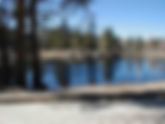
- Arrowbear
updated 05/04/2025 Arrowbear Information Web Site | City Basics ARROWBEAR is an unincorporated community; altitude 6,086 feet, nestled in the San Bernardino Mountains; located east of Running Springs; a mountain community with a population estimate of 736 [2024]. The town gets its name from the fact that it lies halfway between Lake Arrow head and Big Bear . Arrowbear Lake is home to Arrowbear Music Camp, which has been in operation since 1942. Every Summer the air is filled with evening concerts of budding musicians. This small community enjoys a very private environment due to its off the beaten track location. Annual events include a fishing derby in May, a 4th of July celebration, softball games at Tucker Field and other events throughout the year. Considered a place to live in peace. DEMOGRAPHICS : Average house $283K; Average rent $1800; lower than 80% of California; many homes are seasonally occupied; 98% commute to work outside of the city; uncrowded roads, rural, 26 residents per square mile; moderate income neighborhoods; 40% in professional, executive or management work; 25% sales/service; 22% labor/manufacturing; remainder clerical/tech support 12%; 91% speak English; 4% Spanish; 5% other; Mexican 13%; 13% German; 12% English; 9% Irish; 5% Swedish Map of Arrowbear Location of Arrowbear in SBC History of Arrowbear In 1942, Fred Ohlendorf was Supervisor of Music for Long Beach School District. He wanted to celebrate a successful summer season of wartime effort performances with his All-City Junior High Orchestra. Years earlier, the family of Fred’s wife, Edna, had established a church camp in the remote mountain town of Arrowbear. For one week in late August, he brought the fifty-six musicians to Arrowbear. They played concerts for local vacationers and enjoyed camp activities in the extremely rustic outdoor mountain setting. Campers had a very worthwhile experience, and parents and teachers saw the value of a musically oriented vacation. The seed was planted and next year everyone wanted to return. The retreat grew into a multi-session summer camp with full activities. It is predominantly a suburb of Running Springs which started as a logging area. Running Springs includes the small town of Arrowbear and Green Valley Lake; the latter are primarily recreational areas and suburbs of Running Springs. Specific Prayer Points Spiritual Intercessors rise up Bible studies begin in town Revival to those that live there Financial Economy grows Local business fare well Environment Safety in work travels; most Fire safety; sufficient water/rain/snow Crime : [2024] Same data as Running Springs; overall crime grade is C-; violent D+; property D & other is A-; top crime issues are theft at 15% and burglary 5% Arrowbear Music Camp Arrowbear Lake Fire Department Arrowbear Park County Water District Churches [not exhaustive] no churches in the city proper churches are in nearby cities including Running Springs & Lake Arrowhead
- Fontana
updated 05/04/2025 City Web Site Location : It is located approximately 50 miles east of Los Angeles. Due to its geographic location, the City is identified as “…the crossroads of the Inland Empire” Vision : a clean, vibrant, connected, modern city nestled against the San Bernardino mountains Mission Statement : We serve to enrich the lives of all people by embracing opportunity Demographics : est. population [2024] 211,921 .6% annual growth [high] 69% Hispanic; 13% white; 8% Black; 6% Asian; 4% other; average age 31; M:F% 49:51; 65% own their home; avg. household 4 people; 13% less than 9th grade; 11% 9-12th; 28% high school grad; 23% some college; 23% degrees; avg earnings $39K; 51% speak Spanish; 42% speak English; 5% Asian language. Median household income $73K; 47% married; 39% never; 4% widowed; 7% divorced; 2% separated; 5,150 veterans [34% Vietnam; 60% 1st & 2nd Gulf Wars; 3% Korean & WW2] History Founded in 1913, currently second largest city in SBC; 19th largest in California. Began as an agricultural community in 1913, became an industrial town by 1942 from Henry J. Kaiser’s steel mill operations during World War II, on the outskirts of town. This remained a primary source of employment until 1984 when it ceased operation. His legacy lives on at the Fontana Kaiser Permanente Facility, which now employs more than 6,000 people. Since then, the City has continued to grow rapidly due to several factors, including the development of the Kaiser Permanente Hospital facility (one of the largest medical facilities in the region) and the unparalleled population Incorporated on June 25, 1952. Fontana continues to be a vital hub for the supply chain, due to the City’s location at the crossroads of major trade routes (I-10, I-15, and SR-210) and the presence of the Union Pacific Railroad. The City is also home to many large retailers and small businesses. The Fontana Metrolink station provides a low-stress commuting option for residents working in the Los Angeles metropolitan area. Of interest: hosts Fontana Days Half Marathon, considered fastest half-marathon course in the world; includes Center Stage Theater, the Art Depot, the Auto Club Speedway, 59 sports fields including the Dodgers Dreamfield, 48 parks, Pacific Electric Trail, highly acclaimed sports and recreation facilities, and the state-of-the-art Lewis Library and Technology Center. “ Our mission is to actively pursue opportunities in the areas of business retention, expansion, and attraction as a means of promoting economic development within the City of Fontana." Map of Fontana Location of Fontana in SBC Specific Prayer Points Environment : current air quality ; drought severity is moderate ; wind issues, recent earthquakes , population growth, distribution & truck driver issues; current fire outlook Major employers : California Steel, California Aseptic Beverages, Burrtec, Vista Metals, American Security Products, Solaborate, Rotolo Chevrolet, City of Fontana, DSM&T Co., Stc Netcom, Depo Maxzone, Designit, Carpenter House, So. Cal. Bindery, Speedway Government : Current City Council ; under 2nd District of SBC School district : Fontana Unified : 26 elementary; 7 middle; 7 high schools; branch of Chaffey Community college Christian schools :[not exhaustive] Montessori Child Development Center, Living Way Christian, Loveland Academy, Resurrection Academy, First Lutheran, Church of the Chimes, Water of Life, and many more [see link] Crime grade [2024]: Overall crime grade is C-; violent crime C-; property crime D; other crime A-; top issues are theft 14% Gangs : Use WeTip to help solve gang crimes; South Fontana and Mexican Mafia prison gang La Eme Poverty Rate: [2024] 10.3% - 1.7% < CA Avg 12% Spiritual : Churches able to handle the population growth, more Spanish speaking ones arise to meet that demographic, intercessors arise to unite and pray for an awakening, move of God in and through the believers, sweeping move of the Spirit to bring a fresh vision, excitement and desire to repent, turn from sin and share Jesus with others, the move of God goes beyond the church walls into the city, into work places, into schools, into businesses, hospitals and medical places, into neighborhoods, believers will take prayer walks in their community praying for the lost and for laborers for the harvest, praying for those that need healing, giving to those in need, expecting God to move in their city in tangible, manifested ways that causes those who don't believe to give their lives to Jesus and be transformed by the Gospel. Churches & Ministries [not exhaustive] CrossPointe Church Loveland Church Fontana Community Church Cornerstone Baptist Church Fontana Seventh-Day Adventist Church Calvary Baptist Church Relevant Church Inland Empire Iglesia Pentecostal Emmanuel Church Of The Chimes Church of the Hand of God The Rock Christian Church Bethel Christian Fellowship Second Fontana Church St Luke's Episcopal Church West Side Baptist Church Bethel African Methodist Episcopal Fontana Arca De Refugio Fontana de AIC Chinese Christian Family Church Fontana Primera Iglesia Bautista Iglesia Manantial Bethlehem Temple Community Church Cherish Ministry Be The Message Calvary Assembly Of God Calvary Chapel Summit Church Centro De Avivamiento-Iglesia Cristiana Cross Roads Evangelical Free Crossroads Community Church Elisha Rock Baptist First Assembly of God First Faith World Ministries First Lutheran Church First Presbyterian Church Fontana de la Esperanza SDA Church Fontana Foursquare Church Fontana-Juniper Ave SDA Church Fountain Of Truth Family Worship Center Free In Christ Community CC Free In Christ Community Christian Center Friendship Community Fuente De Vida Gloria Dei Lutheran Church Good Samaritan Ame Zion Chr Great Commission BC Iglesia Bautista Emanuel Iglesia Cristiana Encuentro con Dios Ministerios Tesoros Escondidos New Life Community Church Northwinds Church Peace in the Valley Ministry Pentecostal Church Of God Principles Of Faith Christian Center Rainbow Community Praise Center International Resurrection Academy - 8th Grade Resurrection Catholic Church Saint Mary Catholic Church Set Free of South Fontana Shield Of Faith Family Church Sofo Church water Of Life South Fontana South Fontana Community Church Spring of Word Baptist Church St George Parish St Joseph Parish St Mary's Catholic Church St Nicholas Parish Summit Bible Church The Carpenter's House The Church of Jesus Christ of Latter-day Saints The Fontana Church Of Christ The Potter's House Church There Is Hope Ministries There's Hope Ministries Victorious Baptist Fellowship Church Vintage Life Church Water of Life Community Church Fontana Campus Whittier Hispanic Foursquare Church
- Big River
updated 05/04/2025 City web site - Located on the west bank of the Colorado River on the southeast border of the county. Nearest city is Parker in Arizona. Big River is primarily a recreational and retirement community that is comprised of residential, recreation, and vacant lands. People visit here to camp along the Colorado River that separate California and Arizona. There is some commercial activity which includes car repair, storage units, church, beauty shop, and two restaurants. Demographics : Big River has a population around est. 1,025 [2024]. The racial makeup of Big River was (85.7%) White 67%; Hispanic 12% African America 4%; Native American <1%Pacific Islander 4%; Other 5.3% [2021]. History The Big River community has been defined since 1976 by the Big River Community Services District. There are no other agencies confined to the boundaries of the Big River Community Services District. The crux of the issue is that the Big River CSD is located on Indian lands and the determination of its future based upon its unique status of receiving its revenues through leaseholds which terminate in 2029. [for more information click on the History heading] "Business enterprise created under tribal law" Big River Map Details of places Location of Big River in SBC Specific Prayer Points Spiritually Intercessors who live there will rise up & commit to pray for the city Church options at the RV parks (for travelers) Bible studies to spring up & grow Evangelists to be bold in sharing the gospel Coordinated activities to build unity Crime statistics [2024]: overall crime grade D-; violent crime C; property F and other B. Top issues are theft 24% very high and burglary 7%. Poverty Rate : [2024] 19.9%; 7.9% > CA Avg 12% Governed by 3rd District County Supervisor ; Community Service District board members Colorado River Indian Tribes (CRIT). Colorado River Indian Reservation Tribal Government Major services San Bernardino Fire Department Bonnie Baker Senior Center RV campgrounds Churches [not exhaustive] Big River Baptist church [Southern Baptist] nearby churches are in Parker, AZ and Blythe, CA
- Chino Hills
updated 05/04/2025 City Web Site The city borders LA County on its northwest side, Orange County to its south, and Riverside County to its southeast; nearby cities are Brea, Covina, Placentia, Norco and Rancho Cucamonga. Ranked 68th in Money Magazine's "Best places to live 2005." Also the 6th highest income place in the US and ranked the 13th safest city in the United States by the FBI. Chino Hills is a part of the Chino Valley. Also featured as 87 of America’s hottest towns in the January 2004 issue of Money magazine. Chino Hills ranked 8th on the list of “best places in the west with a population under 100,000.” Mission Statement : develop and maintain the aesthetic beauty of the City, while fostering a safe and family-oriented environment. The City is committed to providing excellent customer service, effectively managing growth, and creating a viable financial plan to ensure the continued success of the City. Demographics : est. population [2024] 78,024; Housing Units: 25,877 Total Units 19,969 Single-Family; 883 Single-Family Attached; 5,281 Multi-Family; 627 Mobile Homes; 25,106 Occupied; 3.0% Vacancy Rate; median household income $108K; average household 3 people; 41% Asian; 29% white; 28% Hispanic; 25% 2 or more; 4% African American. Average age 32; 1/3 of the population is under 18. More demographics second source 2,500 veterans; 922 Vietnam; 1,301 Gulf wars; 236 Korea; 41 WWII. 90% US citizens. [2019] the median property value was $622,300, and the homeownership rate was 74.9%. Most people drove alone to work, and the average commute time was 36.9 minutes. The average car ownership in was 2 cars per household. History Incorporated Dec. 1, 1991; rolling hills were home to a few ranches and homesteaders. A handful of property owners appreciated the beauty of the hills. The majority of the residents were red tail hawks, mule ear deer, ground squirrels, mountain lions, cottontail rabbits, and coyotes. Founded in 1907, Boys Republic made Chino Hills its home in 1909. During1920's and 1930's, Sleepy Hollow was a perfect weekend getaway. By 1928, Sleepy Hollow was a summer resort with about 90 cabins, some of which are still in use today. After World War II, these cabins and newer dwellings became permanent residences. The Los Serranos Golf and Country Club, which opened in 1925. Originally, members of the golf club could purchase small lots in the community. Today the course is owned by the family of tennis legend Jack Kramer, who passed away in 2009, and is still a favorite Chino Hills attraction. The natural beauty of Chino Hills in the early 1900's is preserved in Chino Hills State Park. A grass roots organization, known as Hills for Everyone which became the largest California State Park located in an urban setting. Over the next few decades, word was spreading that Chino Hills was a great place for year-round family living. Residents wanted to preserve and protect the hills and guide future development. They were realizing the importance of providing needed services while safeguarding environmentally sensitive areas. In 1979, the County of San Bernardino initiated the development of the Chino Hills Specific Plan. The protected from haphazard development because the land was not flat enough to build inexpensively. The innovative Specific Plan was the first in the State of California to be designed for an unincorporated area. A Citizen's Advisory Committee and County officials worked in cooperation with 150 property owners to develop and implement the plan. “Welcome to the city of Chino Hills; it's a lifestyle." Map of Chino Hills Location of Chino Hills in SBC Specific Prayer Points Environment: current air qual ity not always good due to traffic/smog; recent earthquakes , current fire outlook Major employers : Kaiser, Costco, Lowes, Boys Republic, City of Chino Hills, Albertsons, Chino Hills Fire district, Lucille's Smokehouse BBQ, Western Waterworks, Harkins Theatres Government: City Council School district: Chino Valley Unified ; shared with Chino. Christian schools: Heights Christian; Loving Savior of the Hills, Good Shepherd Christian Preschool; PA College Prep Crime grade [2024] : overall crime grade is B; violent grade B-; property crime C+ and other A-; top issues is theft at 8%. Poverty %: 6.88%; 5.2% < CA Avg 12% Spiritual: Intercessors arise and pray until they see an awakening in the believers, more laborers for the harvest; more evangelical churches reach the lost with new creative ways, people would not get caught up in the cares of this life but remain focused on serving the Lord, not drawn to the buzy-ness from the suburb life; but look for ways to share their faith in the activities, increased hunger for the word and active in the church and community, able to give to other ministries since it is a wealthy city. Churches & Ministries [not exhaustive] St. Paul the Apostle Catholic Baja Christian Ministries Chino Valley Community Church Seven Lampstands Church Good Shepherd Presbyterian Chino Hills Foursquare Church Sehan Evangelical Church of America Abbalove Church Calvary Chapel of Chino Hills Corona Nations Church Loving Savior Of The Hills Lutheran Church Lutheran Church of Missouri Synod Chinese Baptist Church Chino Hills Baptist Church Cornerstone Bible Community Church East LA Baptist Church Hanaro Church Hillside Christian Comm Fellow The Oasis
- Chino
updated 05/04/2025 City Web Site Mission Statement : Together we take pride in providing quality, caring service to our community. Where everything grows! Demographics : est. population [2024] 91,775; The average household income in Chino is $97,392 with a poverty rate of 10.44%. The median rental costs in recent years comes to $1,596 per month, and the median house value is $459,100. The median age in Chino is 37.6 years, 37.9 years for males, and 37.1 years for females. M:F ratio is 56:43; 63% own their homes; 37% rent; average household is 3 people; <9th grade ed 8%; 9-12th grade12%; high school grads; 23%; some college 24%; degrees 30%; 59% speak English only; 28% speak Spanish; 11% Asian languages; 1.6% Indo Euro languages; 43% married, 4045 veterans; most from Vietnam then 1st & 2nd Gulf War, Korean, & WWII; 5% unemployed Hispanic: 27.9%; White: 24.5%; Other race: 19.46%; Asian: 15.21%; Two or more races: 6.21%; Black or African American: 5.50%; Native Hawaiian or Pacific Islander: 0.76%; Native American: 0.51%; annual growth rate is 3%. History Early inhabitants were the Tongva American Indians who lived near the Santa Ana River watershed. Spain claimed the land until Mexican independence. Almost 20 years later, Mexican governor granted Rancho Santa Ana del Chino to the prominent Lugo family. Two years later, his successor took charge of the rancho. They had horses and cattle, which attracted the Native Americans and whites. Read more in the history link above. During California Gold Rush, rancho was a popular stopover for travelers, and in the mining fury, coal was discovered there. In 1850, California was admitted to the union. It became the 'Town of Chino,' and incorporated into a city in 1910. Sugar beets, corn, and alfalfa were raised there. The lower area of the City has always been prone to flooding, and Prado Dam areas are hazardous in times of rain. Race relations reached City wide proportions in the late 60s with many patrol cars burned. Chicano versus White and Chicano versus Black racial animosities have always been present since the late 60s in the Chino region. In the 1970s, Chino developed into a small suburban city, forming the western anchor of the Inland Empire region, and now the city's development has gradually taken on a more middle-class character. There are still many industrial areas as well as farm animals such as goats and chickens. “A vibrant city, great community to live, work and play; that is recognized for integrity and dedication to public service." Map of Chino Location of Chino in SBC Specific Prayer Points Environmental: air quality affected by smog; recent earthquakes ; wind density issues; current fires ; drought status is severe in some parts and moderate in others Government: City Council ; those voted in have high standards, good morals, ethical, handle the finances wisely; in 4th District in SBC ; State Representatives Crime : [ 2024 ] Overall crime grade is C, violent C, property D+, other B+; top issues are theft 11%; vehicle theft 6% Poverty : [ 2024 ] 7.44%; 4.5% < CA avg 12%; One out of every 8.5 residents of Chino live in poverty. Schools: Chino Valley Unified school district : 20 elementary schools; 6 middle schools; 4 high schools Christian schools: Chino Valley Christian, St. Margaret Mary, New Hope Christian, Cornerstone Christian, Lighthouse Christian Spiritual: recovery groups for those dealing with addictions, churches unite in their vision for the city to see transformation, people not get caught up in the buzy-ness of life and spend time with the Lord in prayer and reading the Bible, hunger for God's word, for a fresh filling of the Holy Spirit to be bold in their witness; people empowered to share their testimonies at school and work, a return to first love for God and renewed vision for the lost; laborers to be sent into the harvest, more people volunteer at churches to reach more people, prayer groups rise up and more attendance, intercessors arise to pray UNTIL Chino experiences an awakening, transformation, reformation in the city Churches & Ministries [not exhaustive] Inland Hills Church First United Reformed Church Chino United Methodist Church Crosspoint Church Calvary Chapel Chino Hills Bread of Life Christian Church Living Waters Church Chino Church of Christ Gateway Karis Church Victory Baptist Church Valley Christian Church New Beginnings Ministries Lifesong Community Church Christ-Centered Community Our Lady of Guadalupe First Baptist Church of Chino American Baptist Assemblies of God Calvary Chapel Chinese Fellowship Calvary Chapel Chino Valley Chino – la Hispanic Chino Foursquare Church Chino Free Methodist Church Spanish Chino Seventh-day Adventist Fellowship Chino Spanish SDA Church Christ Lutheran Church Christian Reformed Church in North America Cornerstone Community Church Evangelical Free Church Evangelical Lutheran in America Fellowship of Christ Baptist Church Fortress Community Church Free Methodist Church of North America Hanaro Church Harvest Community Bible Church Immanuel Lutheran Church Joy Partners Living Word Assembly of God Living Word Community Christian Fellowship Lutheran Church of Missouri Synod Mosaic Inland Church New Community Church New Hope Christian Fellowship Park Christian Fellowship Pilipino Community Church Portuguese Speaking SDA Church Portuguese Speaking Seventh-Day Adventist Church Regency Chino Valley Church Saint Margaret Mary Religious Education St Margaret Mary Life Teen Upward Call Church
- Apple Valley
updated 05/04/2025 City Web Site Located east of and adjoining to the neighboring cities of Victorville and Hesperia, 35 miles south of Barstow, and 49 miles north of San Bernardino through the Cajon Pass. Became incorporated on November 14, 1988. DEMOGRAPHICS: population est. 75,478 [2024]; 49/51 M/F; 45% white; 39% Hispanic; 8% African American; Asian 3%; American Indian .5%; Average person per household 3; 14% less than HS; 29% HS grad; 37% some college; 19% bachelor's or more; median income $63K; 67% own; 33% rent; 76% speak English; 19% Spanish. Mission Statement : To provide a better way of life through local control of public safety, development, services and amenities; enhancing our residents’ lives and providing for our community’s future. Vision Statement : A premier community, full of first-class amenities, events, and employment opportunities, Apple Valley will lead the High Desert in public safety and environmental stewardship defining “A Better Way of Life.” History Incorporated in 1988, signs of Serrano Indian camps along the Mojave River in Apple Valley; l late 1800s, the Paiute Indians also migrated to this area. The Mojave River Trail hosted trappers, gold prospectors, pack mules and Mormon wagon trains; in 1860 that the first cabin was built; city name came from all the apple orchards; some say the name “Apple Valley” originated from The Appleton Land Company; By 1920, apples were being grown by the ton at award-winning orchards; orchards died off in the 1930s' ranches were built in the area for those needing the dry desert air as a cure for ailments of all sorts, including tuberculosis and asthma; some provided a place for victims of World War I; people would come to enjoy the western lifestyle where they could ride horses, attend rodeos, and just get away from the big city. Modern founders were Newton T. Bass and B.J. “Bud” Westlund, partners in oil and gas industry; they marketed the area as a resort and quality residential community; built an Inn and Hilltop House for celebrities; soon after there were banks, churches, and a school, along with a golf course, hospital and 180 businesses. “A premier community, full of first-class amenities, events, and employment opportunities, Apple Valley will lead the High Desert in public safety and environmental stewardship defining “A Better Way of Life.”" Map of Apple Valley Location of Apple Valley in SBC Specific Prayer Points Environment: current air quality ; under severe drought conditions , current fire outlook , heavy winds erosion potential, recent earthquakes Government: Town Council in County District 1 Schools: Apple Valley Unified school district : 5 elementary schools pre-K to 6th; 5 pre-school to 8th grade; 2 high schools; adult school; academy for 7-12th; center for innovation Christian schools: Apple Valley Christian Academy, Apple Valley Christian school, St. Timothy's prep school, Valley Christian Fellowship elementary, Mojave Christian, ABC 123 Christian Academy, Oxford prep Crime : [2024] overall crime grade is C-; violent D+; property crime D; other crime is A-; top issue is theft at 14% Poverty rate : [2024] 17.2% [> 5. 2% of CA avg. 12%] The race most likely to be in poverty in Apple Valley is Islander, with 79.09% below the poverty level. The race least likely to be in poverty in Apple Valley is Native, with 4.83% below the poverty level. The poverty rate among those that worked full-time for the past 12 months was 5.39%. Among those working part-time, it was 15.83%, and for those that did not work, the poverty rate was 20.41%. Business list [not exhaustive] Spiritual: laborers for the harvest; people emboldened to share their faith including the children; prayer groups attract more people and see results in their services, growth in the churches; intercessors rise up and pray for an awakening and revival until it happens; more people share in the work of the ministry; united prayers for the city and its needs; people's lives transformed by the Gospel and their testimonies ignite others; changes happen in those who are committing the crimes; ways to overcome financial hardships; churches help the poor Churches & Ministries [not exhaustive] Church of the Valley Presbyterian New Hope Community Church Life Point Baptist Church Calvary Chapel Apple Valley Apple Valley Church of the Nazarene High Desert Church Apple Valley campus Apple Valley Baptist Church Apple Valley Church Of Christ Apple Valley Church Of God Apple Valley Seventh Day Adventist Fellowship Ascension Lutheran Church Assemblies of God Christ The Solid Rock Missionary Baptist Church Christian and Missionary Alliance Church Of Christ, High Desert Church of God in Christ Desert Love Church Of God In Christ Evangelica Emmanuel Faith Ministries Church Inc Full Gospel Church High Desert Chinese Church Holy Apostolic Church of God Pentecostal IB Eben-ezer del Desierto Alto Jess Ranch Community Church Living Waters Chapel Lutheran Church of Missouri Synod New Vision Community Church Our Lady of the Desert Church Pentecostal Church of God Presbyterian Church Of The Valley River Of Life Christian Church Seventh Day Adventist St Timothy's Church The Garden Chapel The Gift Of God Valley Christian Fellowship Victory In Jesus Bible Faith Center Vietnamese Alliance Church of Apple Valley
- Angelus Oaks
updated 05/04/2025 Angelus Oaks Chamber of Commerce SBC Countywide Plan for Angelus Oaks Angelus Oaks is an unincorporated community; surrounded by San Bernardino National Forest; northeast of Redlands on Route 38; consists of a general store, a restaurant, a post office (and a real estate office. A San Bernardino County Fire Station (Station 98) is also downtown, and a San Bernardino County Sheriff's Department Resident Deputy (one of only three in the entire County) lives nearby. The State of California's Department of Transportation (CalTrans) and the United States Forest Service also have a presence in downtown Angelus Oaks. Two private water companies service the residents of Angelus Oaks. Within the town lies the historical Angelus Oaks Lodge, which originally served as a stagecoach stop for passengers traveling up the mountain to Big Bear and is now available for overnight visitors. Demographics : population 371[2024]; 46% M; 54% F; 97% US citizen born; 149 households; 51% with children; average household income $91K; 25% below poverty level; 71% own; 29% rent; 52% Bachelors or Graduate; 21% some high school; 32% some college; 40% single; 32% married; 1% widowed & divorced. Zip code 92305. Small Community Feel. Angelus Oaks residents value a community where residents know each other and are friendly with their neighbors. Peaceful Natural Setting. Angelus Oaks residents value the natural setting of their community. Nestled in the San Bernardino Mountains, residents are close to nature and wildlife, which provides a peaceful and quiet backdrop to their secluded community. Resilience. Angelus Oaks residents value the communities’ focus on resiliency and independence. With the Greyback Disaster Preparedness group, and the communities focus on self-reliance, Angelus Oaks residents know that being resilient is part of their everyday lives. Angelus Oaks a favorite to bicyclists due to the Santa Ana River Trail (S.A.R.T.); offers the San Bernardino Peak Hiking Trai l and Vivian Creek Trail ; few miles past Angelus Oaks, in the Barton Flats area, there are multiple public Forest Service campsites and group camps run by various churches and non-profit organizations, including YMCA and Jewish Community Center of Orange County . The two largest and most active camps are the Boy Scout Camp Tahquitz owned by the Long Beach Boy Scouts serving thousands of Scouts year-round and Camp Cedar Falls , run by the Seventh-day Adventist Church, Jenks Lake hosts fishing and some swimming activities. Also is Mile High Pines since 1945 a Christian camp for all ages. History Angelus Oaks initially Camp Angelus. In 1849 there was a big gold strike in Holcomb Valley, north of Bear Valley and near the town that was later to become Big Bear. The only way to get supplies in and the gold out was by mule trains. The mule train traveled up the Santa Ana River Canyon, stopping overnight in Seven Oaks and then took a switch back trail (Clark's Grade...still visible on the mountain across from the Angelus Oaks Lodge) up to the gold fields. Beginning in the late 1800s and early 1900s, the stagecoach, using the old wagon road, would bring passengers and mail; the Angelus Oaks Lodge was first built as a stagecoach stop and as a small grocery store. In 1919, with automobiles now traveling up the road to Big Bear, the Angelus Oaks Lodge became a perfect spot to replenish the water in their radiators. A few cabins were built by two brothers that owned the Lodge at that time. These crude cabins were nothing more than four walls and contained only cots for sleeping and a wood-burning stove for heat and cooking. In 1953 the first teacher lived with his family in Camp Angelus and taught the community children from five to 13 years of age at Camp Angelus Elementary. In 1956 the natural wood clads (later painted red) one-room schoolhouse serving grades one through seven was built and closed permanently in 2004. In the 1970s, when the postal service decided to combine the two small post offices of Camp Angelus and Seven Oaks, closing the Seven Oaks location, they renamed the remaining office "Angelus Oaks". That name stuck with the town. In 1987, the lodge was purchased and restored which became a livable resort. Currently the cabins are available to rent under a special use permit provided by the USDA Forest Service. HEADLINE NEWS: On February 12, 2013, in a rural area east of Angelus Oaks, the search for Christopher Dorner ended after a standoff with the San Bernardino County Sheriff's Department. He was the primary suspect in a series of shootings. “a biker and hiker's rest stop and home of the infamous Dorner standoff.”" Map of Angelus Oaks Location of Angelus Oaks in SBC Specific Prayer Points Government : Countywide plan : State – San Bernardino County Elections – Registrar of Voters – County of San Bernardino (sbcountyelections.com) ; County – San Bernardino County Elections – Registrar of Voters – County of San Bernardino (sbcountyelections.com) Under District 3 Intercessors who live here to actively pray for the town Residents find churches in the nearby cities to attend Safety for hikers on trails (no crime) Camps: [ recoup financial losses from Covid restrictions, break ins stop, people inhabiting their outbuildings would be turned away and caught; people will experience rest & spiritual renewal] Camp Oakes YMCA Summer Camp Boy Scout Camp Tahquitz [can be used by anyone during the year] Camp Cedar Falls [7th Day Adventist] Mile High Pines Camp [ evangelical ] Crime : [2024] Overall crime grade D+; violent D-; property D; other A-; top crime issues are 14% theft; 6% burglary Poverty : [2024] 3%; 9% < CA Avg 12%; 12 out of 371 people live in poverty Churches [not exhaustive] All churches are located in nearby cities. None in Angelus Oaks proper
- Adelanto
updated 05/01/2025 Adelanto City Web Site Location : Adelanto is a city in San Bernardino County, California about 9 miles (14 km) northwest of Victorville. The name Adelanto means progress or advances in Spanish and was first given to the post office that was established on the site in 1917. Adelanto is alphabetically first among all of California's incorporated cities. Nearby cities include Apple Valley, Hesperia, Oak Hills, Phelan, Wrightwood. DEMOGRAPHICS : Population: Est. [2024) 38,010; growth 3.4% since 2020. 69% Hispanic; 14% African American; 9% White; 5% 2+ races; 2% Asian; .2% American Indian; .2% Pacific islander. 27% not HS graduate; HS graduate 33%; 30% associate or some college; Bachelor's degree or higher 8%; Housing units: 8,834, Labor force: 14,100, Land area: 53 square miles; Median age: 29 years; 49% Female:51% Male; Median Household Income: $62,582; poverty 38.5%; 62% own; 38% rent; 51% speak English only; 46% speak Spanish. History Founded in 1915 by E. H. Richardson, inventor of Hotpoint Electric Iron which he sold then bought land to develop one of the first master planned communities in Southern California. Richardson subdivided his land into one-acre plots, which he hoped to sell to veterans with respiratory ailments suffered during World War I. He also hoped to build a respiratory hospital. While Richardson never fully realized his dream, it was his planning that laid the foundation for what is currently the City of Adelanto. Fruit trees once grew in the city, was famous for fresh fruit and cider, until the depression, then replaced by poultry ranches. Early in 1941, the Victorville Army Airfield was established land within the Adelanto sphere of influence. In September 1950, it was named George Air Force Base in honor of the late Brigadier General Harold H. George. Adelanto continued as a "community services district" until 1970, when the city incorporated, and Adelanto became San Bernardino County's smallest city. The city became a charter city in November 1992. “The city with unlimited possibilities.” Map of Adelanto Location of Adelanto in SBC Prayer Points [with links] Churches experience revival: an awakening, boldness to share their faith; intercessors to arise and pray UNTIL the city is transformed by the Gospel, prison ministries arise to help the detention center; more churches to start up and reach those struggling with drug addictions (high drug crime in this area); pray for deliverance from the drugs and a hunger for the Lord to replace it; reformation to the city because of lives changed. Government : [ District 1 in SBC ] Pray for the leaders to make ethical, healthy financial and economic decisions to improve the businesses, livelihood and vision: department leaders and City Council HIgh Desert Detention Center [2100 inmates] US Dept of Justice Federal Prison Adelanto ICE Processing Center Cannabis operations: pray for those operating illegally to be caught & justice be served so there would be no repeat offenders. ; pray for those operating illegally to be caught & justice be served so there would be no repeat offenders. Largest Employers : Adelanto School District: 869; General Atomics: 250; Northwest Pipes: 173; Commercial Wood Products: 85; Molded Fiber Glass: 85 Newest City Projects : Adelanto Detention Center West; Adelanto High School; Native Sun Power; Victor Phelan Solar; Vulcan Materials Crime statistics : [2024] Overall grade is C; violent crime is C-; property crime D and other crime A-; top crime issues is theft at 14% Poverty Rate [2024] is 16.4% - 4.4% > CA avg 12%; One out of every 2.6 residents of Adelanto live in poverty. Second highest in the county. Environmental issue s: Air quality high score for issues; wind erosion potential; current fires ; drought conditions high as of today in severe drought; recent earthquakes Schools : Poeima Christian schoo l; Adelanto Elementary school district with list of schools including 9 elementary; 3 middle schools; two K-8 schools Churches & Ministries [not exhaustive] Calvary Chapel Adelanto Christ the Good Shepherd Catholic Church Zion Lutheran Church Adelanto Foursquare Church Adelanto Church Of God Centro Cristiano Church Of Christ Adelanto Adelanto Church of Acts Desert Streams Baptist Church Amazing Grace Community Fellowship Schools & Colleges [Seeking Prayer Partners] School & Linked Website School District # Prayer Partners Adelanto Elementary school [AESD] Columbia Middle School [AESD] Donald F. Bradach Elementary School [AESD] Eagle Ranch Elementary [AESD] El Mirage School K-8 [AESD] George Visual & Performing Arts School K-8 [AESD] Gus Franklin Jr. STEM Academy K-5 [AESD] Melva Davis Academy of Excellence [6-8] [AESD] Mesa Linda Middle School [AESD] Morgan Kincaid Preparatory School [AESD] Theodore Vick Elementary School [AESD] Victoria Magathan Elementary School [AESD] West Creek Elementary School [AESD] Westside Park Elementary School [AESD] Bright Futures Academy - Adelanto private Poiema Christian School private Taylion High Desert Academy Charter School Desert Trails Preparatory Academy Charter school Adelanto High School vvuhsd
- PRAYER FOCUS: SBC Smaller Cities
O Jerusalem [SBC], I have posted watchmen on your walls; they will pray day and night, continually. Take no rest, all you who pray to the Lord. Give the Lord no rest until he completes his work, until he makes Jerusalem [SBC] the pride of the earth. Is. 62:6-7 Will you join us in praying for revival to happen in the cities of our county? A city population is less than 25,000 and greater than 2,000. These make up the working class, provide commerce and economic opportunities, are small enough for some, tend to be near populated urban cities which have more than 50K people. Each day we will provide key information to help in prayer. Included will be its history, demographics, crime statistics, poverty level, local businesses, churches & governments, if any and anything of interest for prayer. Let's intercede that the people in these cities will awaken and see revival that spreads to the urban and rural areas. Below will be a podcast and web page about each city updated weekly. Do you live in any of these cities? Any prayer requests for this city? Please e-mail us at sbcuniteandawake@gmail.com . 4/14 Intro Podcast 4/15 Barstow Podcast & Barstow 4/16 Big Bear City Page & Big Bear Lake Page | Podcast 4/17 Bloom-ington Page & Crestline Page | Podcast 4/18 Devore Page & Edwards AFB Page | Podcast 4/21 Fort Irwin Page & Silver Lakes Page | Podcast 4/22 Joshua Tree Page & Lake Arrowhead Page | Podcast 4/23 Landers Page & Lucerne Valley Page | Podcast 4/24 Mentone page & Morongo Valley page | Podcast 4/25 Muscoy page & Needles page & Nipton page | podcast 4/28 Oak Hills Page & Wrightwood Page | Podcast 4/29 Phelan page & Pinon Hills Page | Podcast 4/30 Running Springs Page & Sugarloaf Page | Podcast 5/1 Twentynine Palms Page & Twin Peaks Page | Podcast 5/2 Yermo page & Yucca Valley page | Podcast
- Yucca Valley
updated 04/13/2025 Yucca Valley City Web Site Prayer podcasts: for the city | for the officials Location: An incorporated town that is located 17 miles west of Twentynine Palms, 27 miles north of Palm Springs, 62 miles south of Barstow via State Route 247 and 55 miles (89 km) east of San Bernardino. Bordered in the west by the San Bernardino Mountains and in the south by the Joshua Tree National Park, the town of Yucca Valley is located in the Mojave Desert at roughly 3,300 feet above sea level. Demographics: estimated population [2024] 21,744; median age 42; M:F ratio 1:1; 58% married; 45% have children at home; 88% speak English; 8% speak Spanish; 62% white; 17% Hispanic; 6% black; 2% Asian; 3% American Indian; 10% other; 66% own; 34% rent; 88% high school grad; 12% college; $44K median household income; $27K average income per person; 2,264 veterans Yucca Valley City map Location of Yucca Valley city in SBC History Norman J. Essig was a key player in the late 1950s in working toward establishing Yucca Valley as a place for entertainment celebrities to come and live in privacy. He personally acquired hundreds of acres of land during this time and owned and ran Glenn Realty. He helped to put in the main roads that are running throughout the town off of Hwy 62. He was personal friends with Jimmy Van Heusen the composer and gave him prime real estate in Yucca Valley to build his house which can still be seen atop the highest hill in the center of the town. In 1992, three large earthquakes occurred near the city, the magnitude 6.1 Joshua Tree earthquake on April 22, and on June 28 the 7.3 Landers and 6.5 Big Bear earthquakes. The 7.1 magnitude Hector Mine earthquake on October 16, 1999, had an epicenter 30 miles north of town. On July 11, 2006, a wildfire started by lightning raced through neighboring Pioneertown. The blaze, named the Sawtooth Complex fire, also burned into Yucca Valley and nearby Morongo Valley and destroyed roughly 64,000 acres (26,000 ha) of desert landscape. Yucca Valley is home to the geoglyph "Atlatl" by artist Andrew Rogers. "When it comes to recreation, we offer something for everyone!" Specific Prayer Points Environmental issues: drought, in 2019 there were 72 homeless people, earthquake Governed by: City Council ; 3rd District of the County ; Schools/District: Morongo Unified school district ; Yucca Valley elementary & middle & high schools; Joshua Springs Christian school; Lo Contenta Middle; Calvary Baptist Church school; Our Lady of the Desert elementary; Grace Christian; Orange Elementary; Black Rock High; Friendly Hills Elementary; Calvary Bible Institute Crime issues : 92284 & 92286 [2024] overall crime grade is D violent crime D; property crime D-; other crime B+; top crime issues are theft at 18% and burglary at 5% Poverty rate : [2024] 19.2% [7.2% above CA Avg] 17% M; 28% F; 18-59 yrs 20%; 60-74 17% Points of interest: Desert Christ Park ; Video about it ; High Desert Nature Museum ; Yucca Valley Airport District Spiritual needs: pastors connect to pray and build unifying relationships; intercessors who are residents to claim this area for Christ; to build on the many Christian schools that the children will grow up to serve the Lord; boldness in sharing their faith; laborers for the harvest; ways to help the poor that gets them out of poverty; Bible studies weekly for fellowship, transparency and accountability; prayer groups in each church that preaches the Gospel; transformed lives; reformed community Churches & Ministries [not exhaustive] Crossview Bible First Christian Church of Yucca Valley Yucca Valley Foursquare church Desert Hills Presbyterian church First Assembly of God Evangelical Free church The Well Christian Center Yucca Valley church Yucca Valley United Methodist Church of Jesus Christ Latterday Church of Religious Science St Mary of the Valley Church of the Nazarene Joshua Springs Calvary Chapel St Joseph of Arimathea Hosanna City Church Saint Marys of the Valley Good Shepherd Lutheran
- Yermo
updated 04/13/2025 Yermo City Chamber of Commerce Web Site Prayer podcasts : for the city | for the officials YERMO Yermo which means wilderness in Spanish; unincorporated community in the Mojave Desert It is east of Barstow on Interstate 15, south of the Calico Mountains . Demographics ; estimated population [2024] 846; 17% <high school; 66% high school grad; college 17%; median house is $259K; average family size is 3; average income $58K; median age is 40; 75% white; 2% African American, Asian and American Indian; other races 16%; 47% married; 33% have children in home; 48% own; 29% rent; 23% vacant; 49% work full time; 5% part time; 46% no earnings. Yermo City map Location of Yermo city in SBC History | Recent Footage of Yermo Began in 1902, originally named Otis, Yermo is near the Union Pacific Railroad line. A post office was established three years later with William J. Flavin serving as Yermo's first postmaster. It later developed around serving motorists traveling the Arrowhead Trail (later U.S. Route 91), which ran through the community. Today, Yermo is governed by an elected five-member board of directors comprising the Community Services District authorized by the County of San Bernardino. The board, which meets monthly, oversees the community's volunteer fire department, the Yermo/Calico VFD, as well as its street lighting, parks and water system. Yermo hosts the 1,859-acre storage and industrial annex of the Marine Corps Logistics Base Barstow. Like many small towns, when Interstate 15 opened in 1968, Yermo was bypassed by traffic traveling to and from Las Vegas. This resulted in 90 percent of its local businesses closing. During its heyday, Yermo had many gas stations with mechanics, lots of bars, two grocery stores, a hardware store, a pizza shop, 4 real estate offices, 3 motels, a thrift store, several restaurants, roadside camping sites and two parks. In 2009, it went down to one grocery/general store, one bar, one thrift store, three restaurants, four gas stations, one park, and one motel 3 miles to the south. The fast-food restaurant chain Del Taco was founded in Yermo in 1964; the original structure remains active as a local fast-food restaurant, The Burger Den. Yermo once had a California agriculture inspection station for traffic heading south on Interstate 15. It relocated in 2018 to north of Mountain Pass, between Yates Well Road and Nipton Road. Calico is an old West mining town that has been around since 1881 and was abandoned in the mid-1890s after silver lost its value. The town that once gave miners a good living lost its hustle and became a “ghost town.” Walter Knott purchased Calico in the 1950’s architecturally restoring all but the five original buildings to look as they did in the 1880’s. Calico received State Historical Landmark 782 and in 2005 was proclaimed by then Governor Arnold Schwarzenegger to be California’s Silver Rush Ghost Town. "Gateway to the Calicos" Specific Prayer Points Spiritual: intercessors to arise and pray for their city; pray for the economy to improve, creative ways to bring business and create jobs; more people work; 46% no earnings is high; Churches experience revival; encouraged to keep going despite the pandemic losses Governed by: Yermo Community Services District | County Third District Schools: Yermo school [K-8]; Silver Valley High school Points of Interest: Original Del Taco; Calico Ghost Town & Mountains , Doran Loop and Odessa Canyon; Mule Canyon Road; Marine Corps Logistics Base Barstow [ Video of Calico Ghost Town] Crime statistics : [2024] overall crime grade is F; violent crime is F; property crime F and other crime is C-; top crime issues are very high for the county theft at 51%; assault at 17%; burglary at 13%; and vandalism at 6% Poverty rate : [2024] 12% [same as CA Avg 12%] 103 people below poverty level Churches [not exhaustive] Silver Valley Baptist church [Pastor Cody Frazier] Yermo Bible Church [ICFA]
- Phelan
updated 04/13/2025 City Community Service Web Site Prayer podcasts: for the city | for the officials | for churches/ministries Phelan is located north of Wrightwood in the High Desert, southwest of Victorville, east is Hesperia across the Interstate 15. It is accessible from Highway 138. It is an unincorporated community and census-designated place in the Victor Valley of the Mojave Desert, north of the San Gabriel Mountains. There is talk that Pinon Hills neighboring city to the west might combine with Phelan to form a larger community. Demographics : estimated population [2024] 18,059; 52% white; 32% Hispanic; Asian & Native American 2%; median age 36; M:F 50%:50%; 77% own; 23% rent; average house is 4 people; 16% less than high school; 33% high school grad; 27% some college; 23% college degrees; $37K average income per person; 73% speak English; 24% speak Spanish; 9% other languages; 56% married; widowed 7%; divorced 7%; separated 2%; 29% never married. History Phelan's history dates back to the days of the Mormon Trail, when settlers passed through the area on their way to San Bernardino and points beyond. Phelan was named after Senator James D. Phelan and his brother, John Thomas (J.T) Phelan. Map of Phelan Location of Phelan in SBC Specific Prayer Points | Video About Phelan Environmental issues: heavy winds, dusty, snow a few inches each year; drought Governed by : San Bernardino County 1st District | Phelan Piñon Hills Community Services District (pphcsd.org) Schools/District: Snowline School district ; Phelan elementary; Pinon Mesa middle; Desert view Independent; Heritage school; Serrano High school; Eagle Summit Community Day school Crime issues : [2024] overall crime grade is C-; violent crime D+; property crime D; other crime A-; top crime issues are theft 15% and burglary 5% Poverty rate: [2024] 14.5% [>2.5 over CA avg 12%] 17% Males; 15% Females Points of interest: Forever Wild Sanctuary Spiritual needs: Churches unite in prayer; intercessors arise to claim this region for Jesus; recovery groups for people with addictions, pastors pray together; churches have solid prayer groups; laborers for the harvest; creative ways to reach the lost & broken; an awakening for those who believe; churches find ways to help the poor; reformation in the town Churches & Ministries [not exhaustive] Saint Junipero Serra Church Calvary Chapel Phelan Phelan Community Church High Desert Baptist Church Cornerstone Baptist Church Fountain Living Waters High Desert Church Phelan campus